 New Data from UNOSAT
New Data
As the evacuation of eastern Aleppo proceeds, we have mapped a version of the new dataset released by the United Nations Institute for Training and Research - Operational Satellite Applications Programme (UNITAR-UNOSAT),
1
identifying damaged sites in the city as of September 18, 2016. This dataset is now updated on the main Conflict Urbanism Aleppo interactive map. Assuming that most damage would coincide with the rebel-held parts of Aleppo, we overlaid the dataset onto a map of the areas of control from the same date, traced from Liveuamap.2
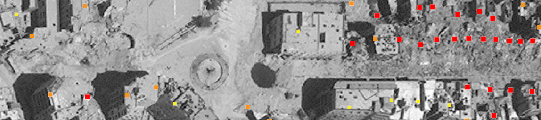
UNOSAT Damage Density Assessment of Aleppo, September 18, 2016. 35,936 dots demarcate damage in the city: red dots show "destroyed" sites, orange show "severely damaged," and yellow show "moderately damaged." This damage is put in context by the zones of control from this same date: the yellow island of besieged rebel-held territory has seen by far the most destruction over the course of the war. Green shows Kurdish territory and grey shows government-held territory.
The pattern is a stark one: damaged sites identified by UNOSAT lie primarily within or just outside the outlines of the besieged areas. It confirms and quantifies what we have seen in countless news articles over the past months. The UNOSAT data allows for a more comprehensive reading of the recent fighting, and confirms the dynamics that have been made clear in news reports and in evidence from the people trapped in the siege through YouTube, Facebook and Twitter: namely that this portion of the city has been systematically bombed and shelled for the duration of the war.
By Neighborhood
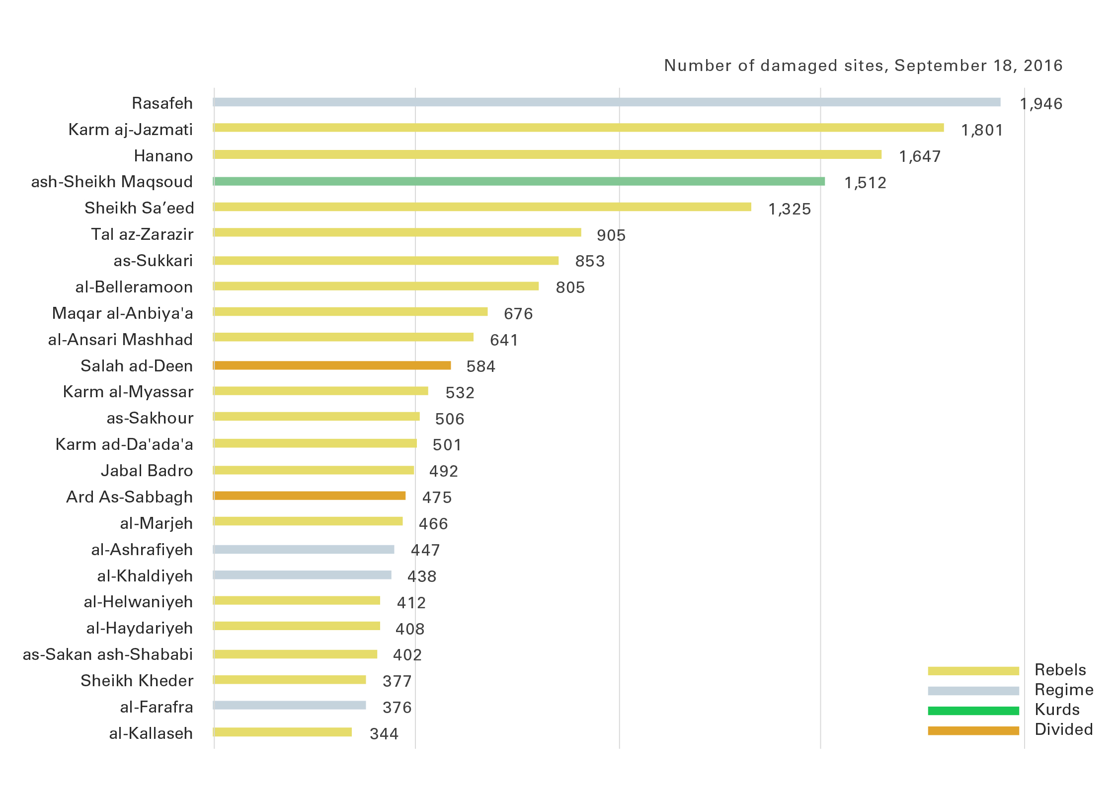
Twenty-five neighborhoods with the most UNOSAT identified damaged sites as of September 18, 2016.
The bar chart analyzes the UNOSAT data another way, and displays the twenty-five neighborhoods with the most identified damage. Twenty of them are within areas that were still held by rebel groups in September, and four of them were controlled by the regime. The most damaged neighborhood, Rasafeh, which on our current September map is in regime held territory, was previously under rebel control. In July 2016, when the government army seized Castello Road, the only route into the eastern part of the city, it took neighboring areas as well, including Rasafeh. With Castello Road blocked, eastern Aleppo became an island under siege, and its residents were denied access to resources – and so a humanitarian crisis was overlaid onto the ongoing military conflict.
3
In September, foreign ministers Kerry and Lavrov negotiated a ceasefire agreement, which would have allowed humanitarian aid to reach the besieged part of the city. The deal collapsed after few days when an airstrike hit a humanitarian aid convoy.
4
Since then, regime forces have resumed their assault on the rebel-held territory. In November, they began systematically taking control of the eastern part of the city, neighborhood by neighborhood, a battle which is now apparently entering its final phase.5
As of mid-December, all of the neighborhoods controlled by the opposition in September 2016 have now been taken over by the regime, with the exception of the Kurdish neighborhood ash-Sheikh Maqsoud in the north and the parts of Salah ad-Deen and Ard As-Sabbagh in the south, which remain under rebel control.
We know that more damage has been incurred between September and now and we will update these maps as data become available.
Return to Case Studies